Netarhat
Netarhat | |
|---|---|
Town | |
 | |
| Coordinates: 23°29′00″N 84°16′00″E / 23.4833°N 84.2667°E | |
| Country | |
| State | Jharkhand |
| District | Latehar |
| Block | Mahuadanar |
| Elevation | 1,128 m (3,701 ft) |
| Languages | |
| • Official | Hindi, Nagpuri kurukh |
| Time zone | UTC+5:30 (IST) |
| Vehicle registration | JH-19 |
| Website | latehar |
Netarhat is a hill station in Latehar district[1] in the Indian state of Jharkhand.[2] The hill station is the among the highest points of the Chhotanagpur plateau. It is known for its natural beauty and waterfalls.[3] It is also referred to as the "Queen of Chotanagpur".[4][5]
Geography
[edit]

Netarhat is located at a height of 1,128 metres (3,701 ft).[6] It is a plateau covered with thick forest.[4] Located in the Pat region of Chota Nagpur Plateau, Netarhat plateau is about 4 miles (6.4 km) long and 2.5 miles (4.0 km) broad. It consists of crystalline rocks and has a summit capped with sandstone trap or laterite. Region of Netarhat is covered with Sal, Kendu, Mahua and Eucalyptus.
Education
[edit]Netarhat Vidyalaya is a residential public school set up in 1954.[7]
Tourism
[edit]Netarhat is known for its hills, dense forest, waterfalls.[3][8] Netarhat has several places of tourist interests:
- Lodh Falls is the highest waterfall of Jharkhand and 21st highest in India. This waterfall is situated at 70 km away from Netarhat and in the forest of Sal.
- Upper Ghaghri Falls is situated 4 km away from Netarhat.
- Naina Fall[9]
- Mahuadanr Wolf Sanctuary is the lone sanctuary in India made for the protection of wolves and mainly consists of Indian wolves.[10]
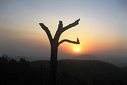
- Magnolia Point, It is 10 km away from Netarhat and is known for its sunset.[3]
- Sunrise Point is situated in Netarhat and known for its sunrise at mornings.
- Lower Ghaghri Falls It is situated 10 km away from Netarhat and is known for its waterfall.[citation needed]
- Koel river View Point is 3 km from Netarhat.
- Suga Bandh Falls is situated at 70 km away from Netarhat and is a picnic spot for locals.
- Sadni Falls is 35 km from Netarhat.[4]
- Betla National Park is situated at 94 km away from the place and known among the first national parks in India to become a tiger reserve under Project Tiger (Palamu Tiger Reserve), 64 km away from Netarhat. It also houses two historic forts of Chero kings.
- Pear Orchards and Pine Forests are initiative of local Forest Department and they planted a lot of trees in the place.
- Lake park
- Sunrise Park
- 90° fall
Transport
[edit]It is located 156 kilometres (97 mi) west of Ranchi, the state capital.[2] It is 118 kilometres (73 mi) from Daltonganj. It is located 82 kilometres (51 mi) from district headquarter Latehar
References
[edit]- ^ "Latehar Road Map". mapsofindia. Retrieved 29 April 2010.
- ^ a b "Gumla -'The land of Gaw-Mela'". traveljharkhand.com. Retrieved 17 April 2010.
- ^ a b c "Autumn of thrill at hill station of Netarhat". Telegraph India. 26 September 2018. Retrieved 20 January 2025.
- ^ a b c "Destinations – Netarhat". Bihar State tourism Development Corporation. Archived from the original on 29 March 2010. Retrieved 17 April 2010.
- ^ "5 pretty hill stations". Times of India. 25 March 2024. Retrieved 20 January 2025.
- ^ "Netarhat, India page". Falling Rain Genomics. Retrieved 23 April 2010.
- ^ "Netarhat Vidyalaya". Retrieved 17 April 2010.
- ^ "Netarhat Tour, Netarhat Sightseeing, Sunset Point, Netarhat School - Travel News India". travelnewsindia.com. 19 February 2017.
- ^ "Neglected' Naina Waterfall In PTR Set For Overhaul". Times of India. 22 March 2023. Retrieved 20 January 2025.
- ^ "IN: Official apathy hits country's lone wolf sanctuary | Timber Wolf Information Network". Retrieved 24 November 2019.


